We were looking for a convenient place to anchor north of Staniel Cay area before spending some time at the Land & Sea Park at Warderick Wells. Christa suggested Pipe Cay since on the island, there were ruins of a Decca Navigator site abandoned since 1970’s.
I had been exposed to LORAN-C and Omega navigation systems during my flying days, but I had not heard of Decca so I Googled it. From the Wiki site, “The system was invented in the US, but development was carried out by Decca in the UK. It was first deployed by the Royal Navy during World War II when the Allied forces needed a system which could be used to achieve accurate landings and was not known to the Germans and thus free of jamming.” I was surprised to learn Decca was a system that lasted well into the GPS era when the Japanese closed their last site in 2001.
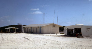
After we left the island we found some pictures of the original site, so it was interesting to see a number of the same places that we had been sniffing around. Thanks to Jerry Proc for use of pictures from his Hyberbolic Radionavigation Systems page.
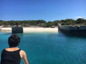
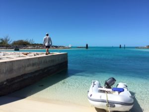
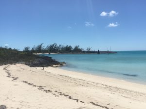
All of the harbour infrastructure is still in place. There looked to be more than 4 feet depth at the main dock at low tide so it still could be used, with lots of fenders out to protect from the flat cement face. A fellow cruiser said they remember another boat tied up there for a number of months a few years ago, slowly working away at some boat repair and maintenance. There are also some pictures online showing 3-4 cruising boats tied up to the main wall.
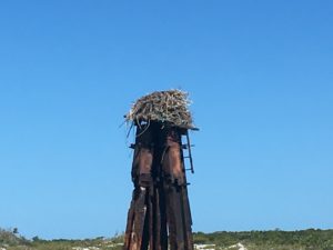
Leading the safe channel into the harbour from the west, there were these monster pylons listed as “tripods” on the Explorer Chart. This one has an osprey nest that has been built up over the years. We saw some activity at one point, but it’s so big even the adult birds vanish below the sides.
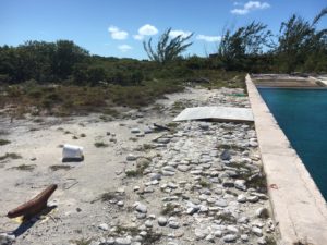
The harbour dock walls are all in very good condition.
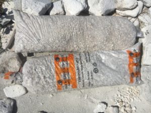
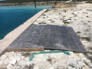
It appears someone is or was planning a project along the dock, with a plywood ramp and bags of gravel.
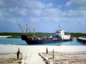
Here’s an old photo showing the same harbour wall relative to the size of the old supply ship.
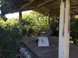
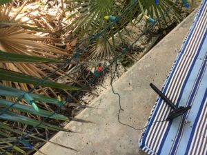
On the left side of the main building, there was a well-built shelter with a cement foundation and metal corrugated roof that was still in pretty good shape. Someone had positioned a lounger mattress, flanked by solar powered Christmas lights in the far corner. We didn’t investigate the setup too closely…
Here you can see the shelter in relation to the original infrastructure. The building on the far right is no loner there.
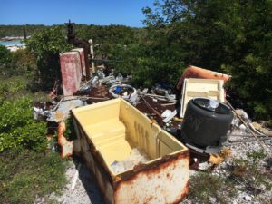
There always seems to be a garbage pile when exploring these uninhabited islands.
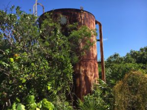
The original water tank is still standing.
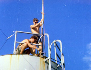
Some of the guys on the same tank trying to get better TV reception back in the day.
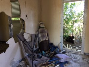
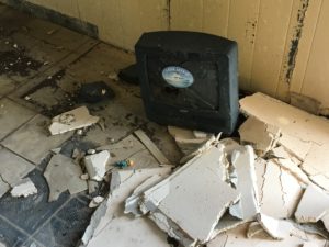
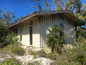
The main building is still standing, but the inside has been gutted. That’s a propane tank dressed up like a person on the left.
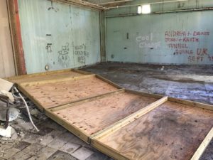
Someone had a project in mind with four 4 X 8 plywood sheets framed into a wall. Building materials are a hot commodity on the small islands so it’s surprising they’re still sitting here.
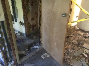
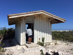
This door and frame seem to be very recent. It has been trued and closes tight, which was strange with the rest of the surroundings.
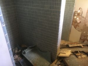
Bathroom tile is still in great shape, even though the rubble pile is up over the urinals.
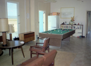
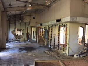
A before and after picture of the main lounge.
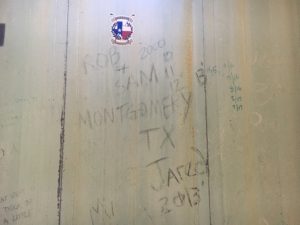
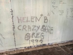
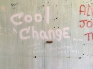
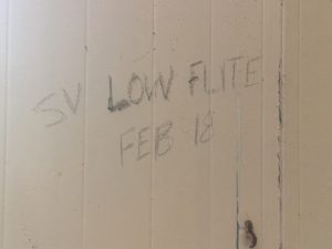
You can generally tell how long a place has been abandoned by the age of the graffiti. The oldest we found was from 93. We made our little contribution (bottom right) from a piece of charred wood left in a fire pit, since we keep forgetting our can of spray paint back at the boat…
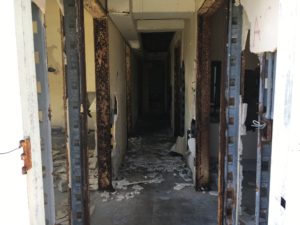
A view of the outside of the main building, heading inland towards the east side of the island.
Here’s an aerial view of the original facility. The conduit is leading to the power generating building to the bottom of the picture which is east(ish). If you follow the line made by the conduit to the top of the picture, we were anchored just about in that same direction with 3 other boats.
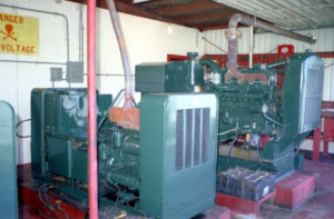
What we thought must have been the power generating room a few hundred metres from the main building, turned out to be just that. The big diesels were no where to be found.
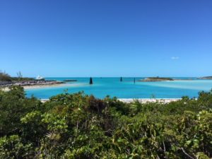
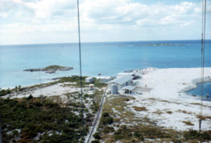
A view of the harbour from the high ground with the three pylons visible in the channel.
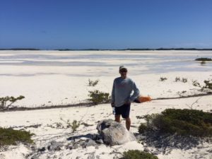
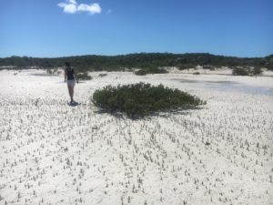
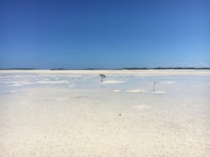
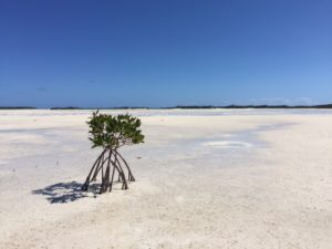
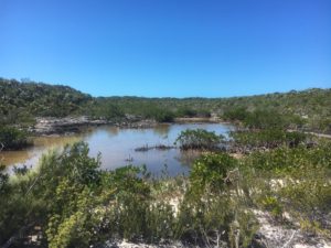
The east side of the island is famous for mostly drying out at low tide. Great for exploring by SUP, kayak, etc. You can walk out almost a kilometre through sand and some shallows. There is easily enough room to land a light aircraft on balloon/tundra tires. We read that fish and conch get stuck in the shallows, but didn’t find any. The mangrove seemed to be very healthy and was expanding.
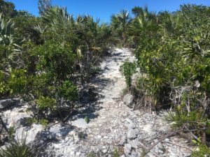
There are a few trails that lead to other beaches around the island.
Someone had taken the time to line some of the paths with rocks and conch shells.
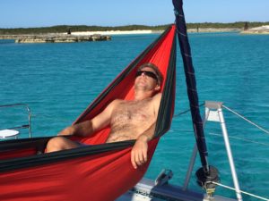
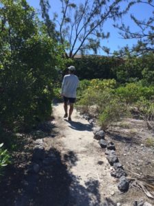
Pipe Cay is a great place to go exploring and offers good protection from the wind at anchor…so you can make sure the hammock still works.
Another great day exploring.